Boston Harbor Mass. Coastal Survey 1850 Blunt nautical map hand color
Brian DiMambro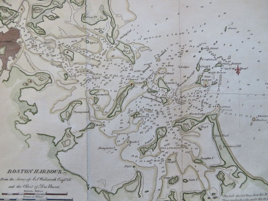
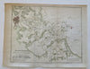
Boston Harbor from the Survey of A. Wadsworth.
(Old Maps, 19th Century Maps, North America, United States, New England, Massachusetts, Boston, Boston Harbor, Nautical Chart, Coastal Survey).
Issued 1850, New York by E & GW Blunt. Engraved by Hooker.
Mid 19th century engraved map with attractive hand color.
Superior visual example with pleasing age patina.
Various assorted wrinkles, left side blank margin extended with old paper to facilitate framing, nice looking example with pleasing age patina. Any age flaws mostly minor and easy to overlook or forgive.
Original fold lines as issued.
Sheet Measures c. 9 1/2" H x 11 1/4" W.
Engraved Area Measures c. 8" H x 10" W.
Cartographic Reference(s):
Tooley's Dictionary of Mapmakers, vol. 1.
[R35044].