Eastern Europe Russian Empire Poland Prussia Livonia Estonia 1848 Stulpnagel map
Brian DiMambro- Antiquarian Books, Maps & Prints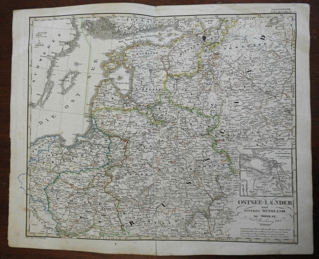
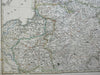
Ostsee-Laender und Inneres Russland bis Moskau.
(Europe, Eastern Europe, West Prussia, East Prussia, Poland, Lithuania, Russian Empire, Baltic Sea, Courland, Latvia, ).
Issued 1848 Gotha by Justus Perthes for Stieler. Map by Stulpnagel.
Very detailed 19th century engraved map with original outline hand color.
Stieler maps went through continual revisions. Thus, for any specific Stieler map such as this one, there are often numerous variant issues with varying details.
Nice looking example, a 3" split up bottom centerfold (no loss of printed area), small dark stain near St. Petersburg, pleasing age patina, any minor age flaws easy to overlook or forgive.
Original center fold as issued.
Sheet Measures c. 13 3/4" H x 17" W.
Cartographic Reference(s):
Tooley's Dictionary of Mapmakers, vol. 4.
[R25731].