Electorate of the Palatinate Holy Roman Empire Germany 1708 de la Feuille map
Brian DiMambro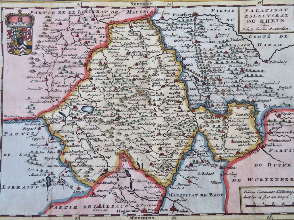
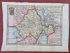
Palatinate Eslectoral du Rhein.
(Old Maps, 18th Century Maps, Europe, Holy Roman Empire, Germany, Palatinate, Elector Palatine, Mannheim, Heidelberg).
Issued 1708, Amsterdam by de la Feuille.
Early 18th century engraved map with lovely hand color.
Map sheet backed long ago with old hand made paper.
Remains a nice looking example with a pleasing age patina. Any age flaws mostly minor and easy to overlook or forgive.
Original fold lines as issued.
Sheet Measures c. 7 3/4" H x 10 1/2" W.
Engraved Area Measures c. 7" H x 10" W.
Cartographic Reference(s):
Tooley's Dictionary of Mapmakers, vol. 1.
[R33570].