Holy Roman Empire Germany Austria Bohemia Bavaria Brunswick 1719 Mallet map
Brian DiMambro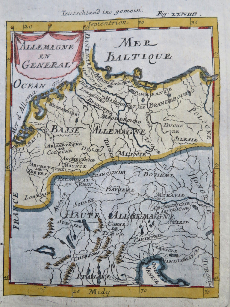
Allemagne en General.
(Old Prints, 18th Century Maps, Mallet Prints, Europe, Holy Roman Empire, Germany, Austria).
Issued 1719, Frankfurt, for A.M. Mallet.
Charming 18th century copper engraved print with lovely hand color.
The image has a near folk-art feel, a style unique to this historical era. Utterly unlike anything produced today and of modern aesthetic appeal for this reason.
Mostly clean and well preserved example, the image displays a pleasing age patina.
Sheet measures c. 7 7/8" H x 5 7/8" W.
Printed area measures c. 5 1/2" H x 4" W.
Cartographic Reference(s):
Tooley's Dictionary of Mapmakers, vol. 3, pp. 196.
[R33552].