Missouri Illinois Indiana Ohio Kentucky & Tennessee Nashville 1850 scarce map
Brian DiMambro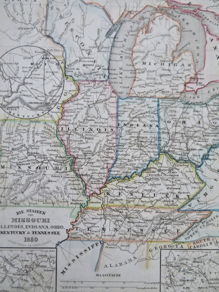
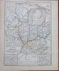
Die Staaten von Missouri, Illinois, Indiana, Ohio, Kentucky, & Tennessee.
(Old Maps, 19th Century Maps, North America, United States, Missouri, Illinois, Indiana, Ohio, Kentucky, Tennessee, Nashville, Lexington).
Issued c. 1850, Hildburghausen, Germany by the Bibliographic Institute.
Mid 19th century antique engraved map with original outline hand color.
Note how beside the straight western border of Wisconisn is simply "Sioux" Indians.
Well preserved, nice looking example with pleasing age patina.
Sheet Measures c. 11 3/4" H x 9 3/4" W.
Engraved Area Measures c. 9 3/4" H x 7 1/4" W.
Cartographic Reference(s):
Tooley's Dictionary of Mapmakers, vol. 1.
[R33649].