Noricum & Vindelici Roman Empire 1729 decorative map Northern Italy Austria
Brian DiMambro- Antiquarian Books, Maps & Prints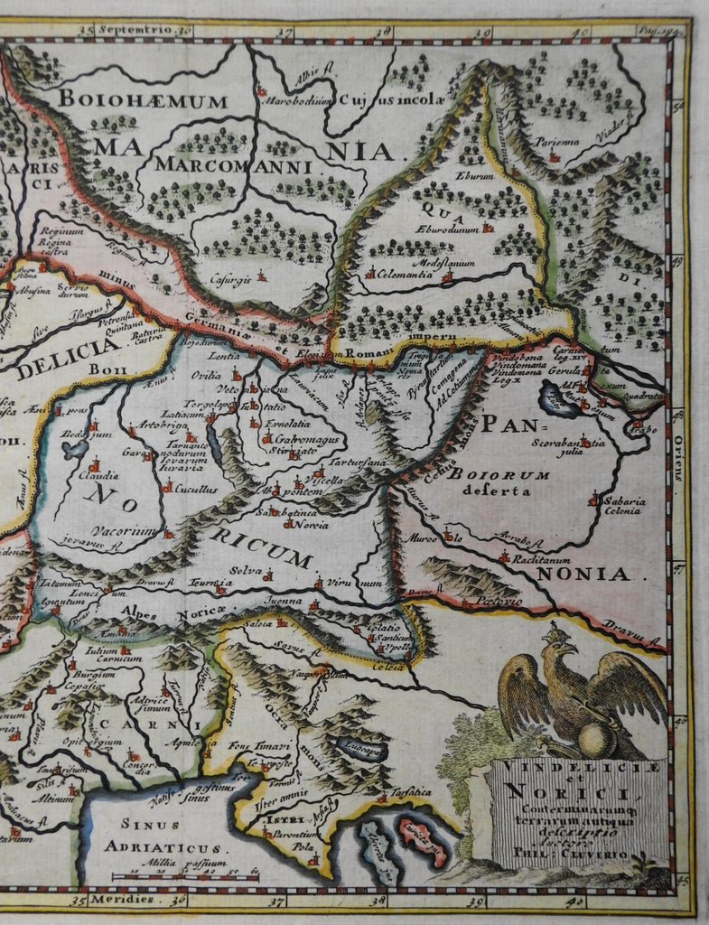
Vindeliciae et Norici.
(Ancient World, Roman Empire, Vindeliciae, Noricum, Gallic , Austria, Northern Italy).
Issued 1729, Amsterdam for Cluverius.
Early 18th century engraved historical map with attractive hand color.
Note the large crowned eagle above the title at lower right, across from ancient Venice and the Adriatic peninsula of Istria.
Remains a nice looking example with a pleasing age patina. Any age flaws mostly minor and easy to overlook or forgive.
Original fold line as issued.
Sheet Measures c. 9 1/2" H x 11 1/2" W.
Engraved Area Measures c. 8" H x 10" W.
Cartographic Reference(s):
Tooley's Dictionary of Mapmakers, vol. 1.
[R36066-R26171].