South Carolina Charleston Columbia 1857 Morse miniature state map
Brian DiMambro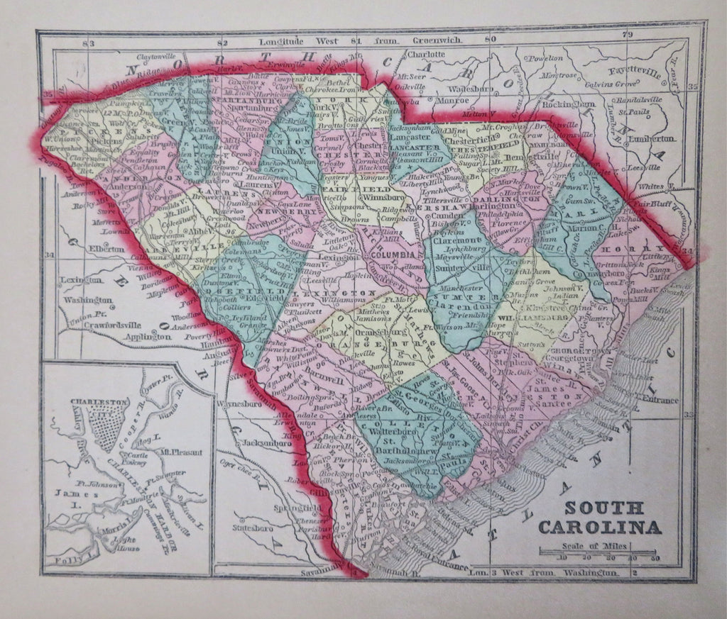

South Carolina.
(Old Maps, 19th Century Maps, Americana, United States, South Carolina, Columbia, Charleston).
Issued 1857, New York by Morse & Gaston for Colby.
Mid 19th century cerographic (wax engraved) map with original hand color.
Nice looking example, clean, pleasing age patina, any minor age flaws easy to overlook or forgive.
Sheet Measures c. 6" W x 7 1/4" H.
Printed Area Measures c. 5" W x 6 " H.
Cartographic Reference(s):
Tooley's Dictionary of Mapmakers, vol. 3 pp 285.
Ristow, American Maps & Mapmakers, pp. 154, 468 & 469.
[B12744].