United States 1808 Wabash & NJ Co. & Army Lands 1781 Treaty of Peace scarce map
Brian DiMambro- Antiquarian Books, Maps & Prints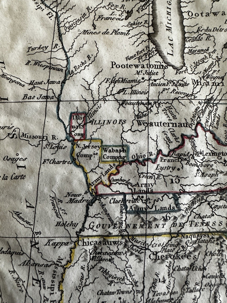
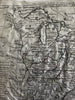
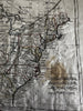
Les Etats Unis D'Amerique.
(Old Maps, 19th Century Maps, North America, United States, New England, New York, Pennsylvania, Northwestern Territory, Kentucky, Tennessee, Georgia, South Carolina, North Carolina, Virginia).
Issued 1806, Paris by Desray for Herisson. Engraved by Glot.
Scarce early 19th century antique engraved map with original hand color.
Of historical note for the depiction of different land grants which include "New Jersey Company", 'Army Lands", "Illinois Company" and "Wabash Company" as well as "Ohio Company" and another unnamed one beside it. Government of Tenessee (sic) named, Georgia curiously unnamed (named within the key only) but territorial across to the Mississippi river and essentially all tribal names. District of Maine with a curious outline shape, Florida still divided into East and West.
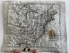
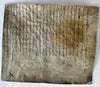
Affixed long ago to an early vellum leaf with 17th century manuscript writing on it. Large old light stain indicates they’ve been joined for possibly hundreds of years.
Poor condition on technical levels, yet utterly unique example and still a great historical map. One of only a handful of this era which depict these short-lived land grant areas as officially part of the geographical landscape.
Wrinkling and puckering to vellum, thus to map sheet as well.
B152309