Vienna Austria-Hungary Hapsburg Empire c. 1850's Heck engraved city plan map
Brian DiMambro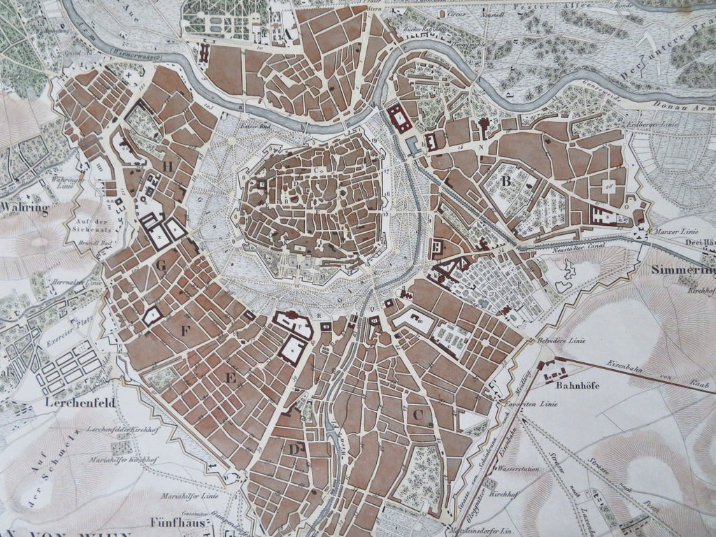

Plan von Wien.
(Old Maps, 19th Century Maps, Europe, Austria-Hungary, Austria, Vienna, City Plan, Fortifications).
Issued c. 1850's, Germany by Heck. Engraved by R. Schmidt.
Mid-19th century engraved city plan map with attractive hand color.
Remains a nice looking example with a pleasing age patina. Any age flaws mostly minor and easy to overlook or forgive.
Sheet Measures c. 9 1/2" H x 11 1/2" W.
Engraved Area Measures c. 8 1/4" H x 10 1/2" W.
Cartographic Reference(s):
Tooley's Dictionary of Mapmakers, vol. 1.
[R33639].