Caribbean South America Christian Missions large detailed 1950s old map
AntiqueMapsPrints.com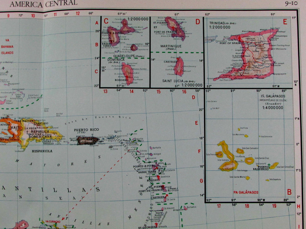
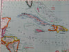
America Central
(Caribbean / Cuba / Dominican Republic / Haiti / Trinidiad / Puerto Rico)
Issued by St. Gabriel Mission presses, Vaticana, Vienna, Austria, c. 1953. (Church Propaganda cartography)
Large inset map of Baja Peninsula at bottom left. Meanwhile, top right of map features 6 smaller insets (Guadelpupe, Dominica, Martinique, Saint Lucia. Trinidad, and the Galapagos Islands).
With small inset maps of Ascension Island and St. Helena at bottom left.
Fascinating early to mid 20th century vintage color lithographed thematic map, overprinted in red, locating Christian Missions across the region.
Of note as well for the uncommon issuance source.
Captures the region at a fascinating point in mid-20th century history.
Minor light toning as typical for paper of this vintage, clean nice looking example of this vintage map.
Original fold line as issued. Large folio sheet.
Sheet measures c. 25 1/2" x 19 1/2"
Engraved area measures c. 21" x 17 3/4"
[R12937]