Missouri St. Louis Springfield 1845 USG antique early state survey map
AntiqueMapsPrints.com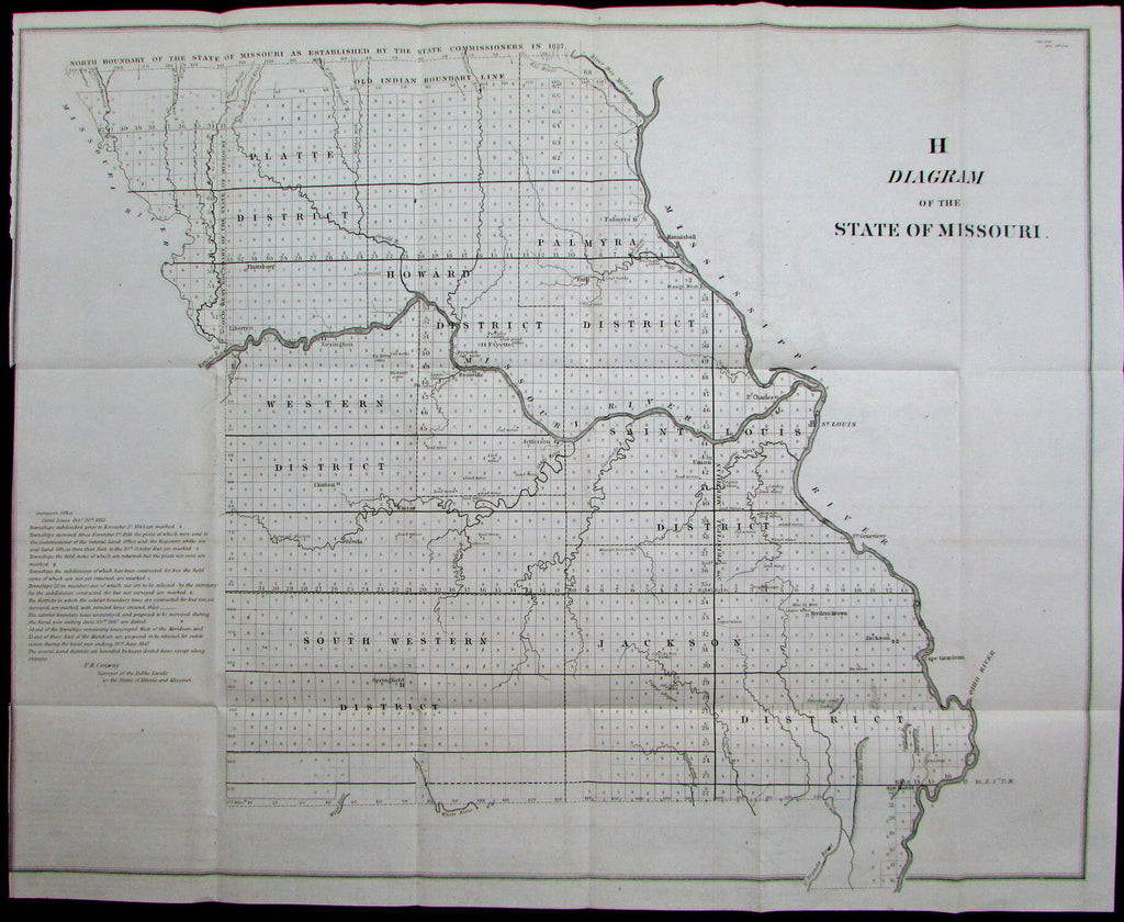
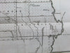
Diagram of the
State of Missouri- Surveyors Office, Saint Louis, 30 Oct 1845. F.R. Conway.
Issued Washington, D.C., 1845 by U.S. Government for Sen Doc
Early lithographed official topographical survey of this western U.S. state.
Earliest Districts named with early boundary delineations. Numerous mines are named & located, Old Indian Boundary Line across top below the 1837 State Commissioner boundary line. Notes engraved lower left.
In well preserved condition, minor light surface age wear and toning as typical, overall the printed area is clean. Paper is sound, still supple, much better quality than often seen on slightly later USG lithographed maps such as Annual Survey volume coastal charts.
Original fold lines as issued.
Sheet measures c. 23" x 18 1/4"
Engraved area measures c. 22" x 17"
[R12192]