Providence Rhode Island Cranston Attleborough Massachusetts 1890 topo coast map
AntiqueMapsPrints.com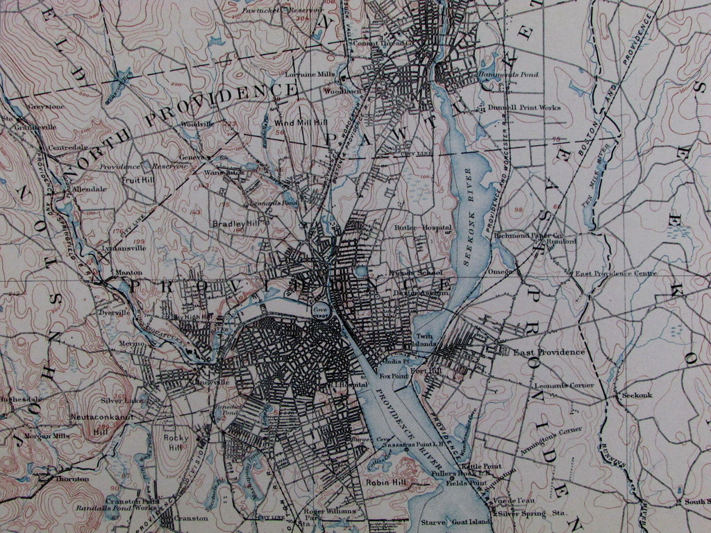
Mass-R.I.
Providence Sheet
(Cranston / North Attleborough / Seekonk)
Issued Boston / Washington, D.C., 1890 by U.S. Government.
Compiled chiefly from U.S. Coast and Geodetic Survey.
Lithographed by Forbes Co. (Boston & New York).
Detailed late-19th century folio-sheet map. Depicts interior terrain features, as well as locating numerous specific houses along local roads, etc.
Minor light toning, slight dustiness, but overall remaining clean and well-preserved. Nice looking antique map, entirely worthy of display or gift-giving.
Printed on very thick heavy paper stock, almost like thin flexible cardboard, a feature not commonly seen on coastal maps and charts of this era.
Sheet measures c. 20 1/2" x 17".
Printed area measures c. 18 1/2" x 13 1/4".
[R13412]