Ancient World Europe North Africa Middle East India Mediterranean 1797 map
Brian DiMambro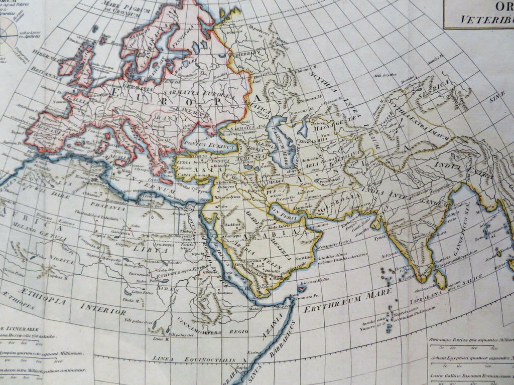


Orbis Veteribus Notus.
(Old Maps, 18th Century Maps, World Maps, Africa, Europe, Asia, Middle East, India, Red Sea, Indian Ocean, Mediterranean Sea).
Issued 1797, London by Cadell & Davies.
Late 19th century engraved historical map with attractive hand color.
Remains a nice looking example with a pleasing age patina. Any age flaws mostly minor and easy to overlook or forgive.
Original fold lines as issued.
Sheet Measures c. 8 1/2" H x 14 1/4" W.
Engraved Area Measures c. 8" H x 12 1/2" W.
Cartographic Reference(s):
Tooley's Dictionary of Mapmakers, vol. 1.
[R31067].