Astronomy Diagram Charts c. 1770-90's map climate longitude latitude zones globe
Brian DiMambro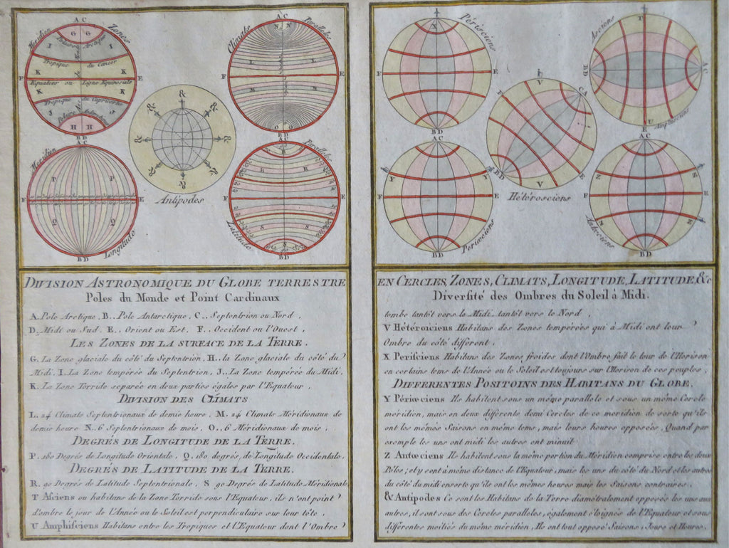
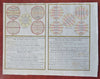
Division Astronomique Du Globe Terrestre.
(Old Prints, 18th Century Prints, Astronomy, Terrestrial, Longitude and latitude, Dissected Earth, Equatorial diagrams, Spheres, Antipodes).
Issued c.1770-90's, likely Paris. Anonymous engraver/ maker. Two small maps engraved on a single sheet.
Ten small detailed diagrams sit atop two columns of descriptive text relating to the globes and circles. Subjects include climate zones, longitude, latitude, axis and rotation of planets, inhabitants by region, etc.
Interesting little didactic mid to late 18th century engraved map, with very attractive hand color. A pleasing visual example.
Remains a nice looking example with a gentle age patina. Any age flaws minor and easy to overlook or forgive.
Sheet Measures c. 7 5/8" H x 10" W.
Engraved Area Measures c. 6 3/4" H x 9" W.
Cartographic Reference(s):
Tooley's Dictionary of Mapmakers, vol..
[B12431].