British India Southeast Asia Qing China Tibet Malaysia 1867-9 Mitchell map
Brian DiMambro- Antiquarian Books, Maps & Prints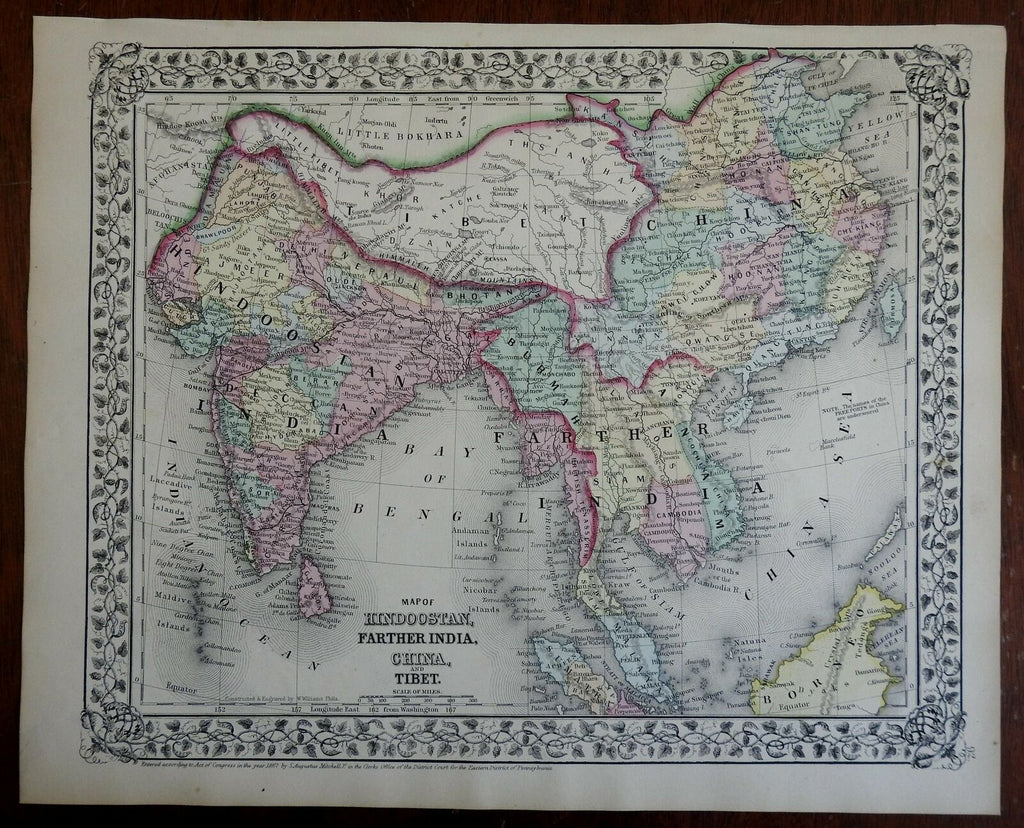


Map of Hindoostan, Farther India, China, and Tibet.
(Asia, British Raj, India, Tibet, Qing Empire, Southeast Asia, ).
Issued c. 1867-9, Philadelphia by S.A. Mitchell.
19th century engraved map, with original hand color. Mitchell maps of this mid-century era were issued with a range of color as well as variant decorative borders.
Nice looking example, pleasing age patina, any minor age flaws easy to overlook or forgive.
Sheet Measures c. 12 1/2"H x 15 1/4" W.
Engraved Area Measures c. 10 1/2" H x 13 1/2" W.
Cartographic Reference(s):
Reps, American Maps and Mapmakers, p. 313.
Tooley's Dictionary of Mapmakers, vol. 4, pp. 260.
[R25802].