California as Island sailing ships New World North South America 1686 Mallet map
Brian DiMambro- Antiquarian Books, Maps & Prints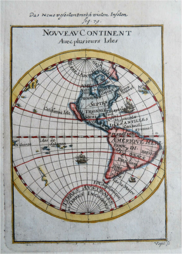
Nouveau Continent.
(Old Prints, Mallet Prints, Western Hemisphere, North America, South America, California as an Island).
Issued 1686, Paris, for A.M. Mallet.
Charming 17th century copper engraved map with lovely hand color.
Vivid and clear cartographic depiction of California as an island. The earliest state of this charming miniature map which has the sailing ships in the oceans.
The image has a near folk-art feel, a style unique to this historical era. Utterly unlike anything produced today and of modern aesthetic appeal for this reason.
Mostly clean and well preserved example, the image displays a pleasing age patina.
Sheet measures c. 7 7/8" H x 5 7/8" W.
Printed area measures c. 5 1/2" H x 4" W.
Cartographic Reference(s):
McLaughlin, Mapping of California as an Island, 84.2.
Tooley's Dictionary of Mapmakers, vol. 3, pp. 196.
[R27483].