Enckhuysen Holland Sailing Ships 1634 Hondius detailed full hand color city plan
Brian DiMambro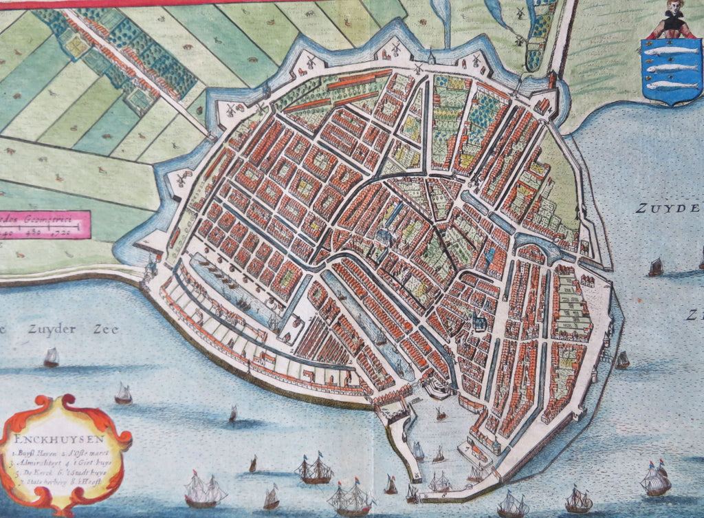


Enckhuysen.
(Old Maps, 17th Century Maps, Europe, Low Countries, Netherlands, Holland, Enckhuysen, City Plan, Canals, Windmills, Sailing Ships).
Issued 1634, Amsterdam by Hondius.
Outstanding and wonderful early 17th century engraved city plan bird's eye view with what is almost certainly original full hand color.
Fantastic detail in this visual gem of a map, with hundred of individual houses rendered, even garden plot layouts are show.
Lovely ornamental title cartouche and city coat of arms, sailing ships, city walls, windmills, etc.
Well preserved, nice looking example with pleasing age patina.
Original center fold as issued.
Sheet Measures c. 9 3/4" x 6 3/4".
Engraved Area Measures c. 9 1/8" H x 6 1/8" W.
Cartographic Reference(s):
Koeman, Atlanted Neerlandici, not catalogued. See Koeman, Geschiedenes der Kartographie, p. 129.
From the very rare 2nd edition of Tonneeel ofte Beschrijvinghe des landts end steden van Hollandt end West-Friesland by M.Z. Boxhorn. This edition superior to the 1632 version because the maps were issued with blank versos on separate sheets instead of on sheets with printed text.
[B12434].