French Guadeloupe Caribee Islands Caribbean 1759 Bowen scarce periodical map
Brian DiMambro- Antiquarian Books, Maps & Prints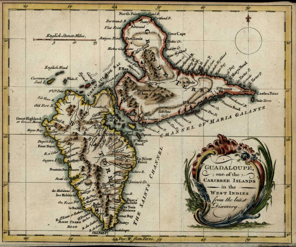

Guadaloupe, one of the Caribee Islands in the West Indies from the latest Discovery.
(North America, Caribbean, West Indies, Guadeloupe).
Issued London, 1759 by Emanuel Bowen.
Charming little mid-18th century antique map, engraved with pleasing full hand color.
Map is affixed to what appears to be a hand-made thick paper backing, minor light surface age wear and toning as typical, but overall a superior visual example.
Sheet measures c. 9 1/4" x 7 1/2"
Engraved area measures c. 8 1/2" x 7 1/4"
Tooley's Dictionary of Mapmakers , vol. I, pg. 176.
Jolly, Maps in British Periodicals , UNIV-76.
[R21095]