Holland Netherlands Nederland c. 1655 Ortelius Turrini rare miniature map
Brian DiMambro- Antiquarian Books, Maps & Prints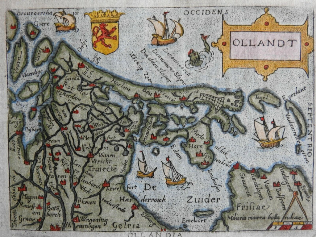
Ollandt.
(Europe, Low Countries, Netherland, Holland, Zealand, Amsterdam, Rotterdam, Utrecht, Haarlem, Zuider Zee).
Issued c. 1655, Venice by Turrini for Ortelius.
Delightful decorative little map with sailing ships, a crest, strapwork title and a sea monster.
Charming, attractive well-preserved 17th century engraved miniature map with lovely hand color. Scarce re-issue of Marchetti's 1598 plate. North is to be found on the right (west) side of the map.
A close comparison of this c.1655 example with the 1598 printing reveals the engraved plates used were identical.
Remains a nice looking example, clean with a pleasing age patina. Any age flaws mostly minor and easy to overlook or forgive. Text on reverse.
Sheet Measures c. 5 1/2" x 3 1/2".
Engraved Area Measures c. 4" x 3".
Cartographic Reference(s):
Koeman, III, Ort [70].
Burden, Mapping of America, 48-50 (mentioning this Marchetti 1598 edition).
[R26259].