Lake Sunapee New Hampshire 1897 large color RR line map shows hotels businesses
Brian DiMambro- Antiquarian Books, Maps & Prints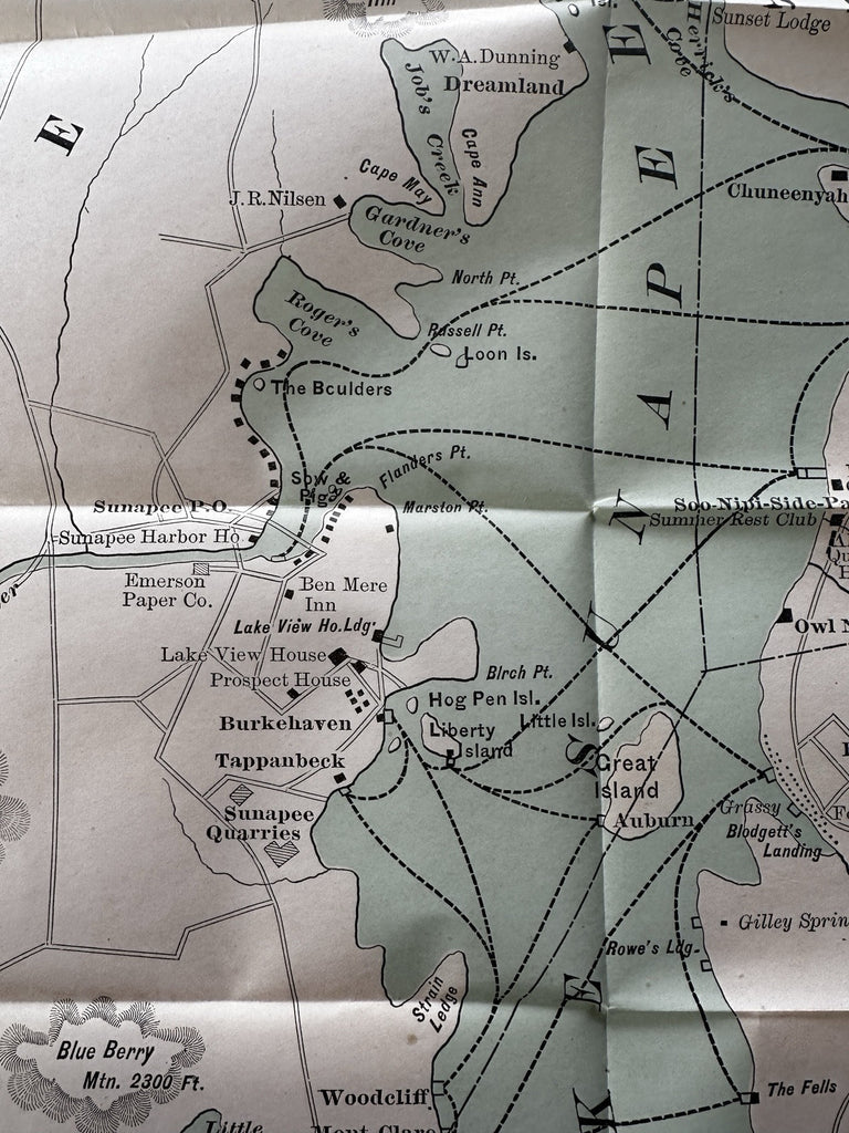
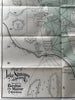
Map of Lake Sunapee and Vicinity, Reached by Boston and Maine Railroad.
(Old Maps, Early 20th Century Maps, Americana, United States, New England, New Hampshire, Lake Sunapee, Newbury, New London, Boston and Maine Railroad).
Issued 1897, Boston by Rand Avery Supply Co.
Late 19th century century color lithographed map. Printed on thin sturdy bond paper.
Locates the steamer lines, numerous businesses and people such as Prospect House, Lake View House (hotels), Emerson Paper Co., Sunapee Harbor House, Prof. JB Quackenbos, Col. John Hay, George's Mill & Lodging, Blodgett's Landing, Pine Cliff, etc.
Well preserved, clean, nice looking example with pleasing age patina.
Original fold lines as issued.
Sheet Measures c. 19" H x 14 1/2" W.
Cartographic Reference(s):
Tooley's Dictionary of Mapmakers, vol. 4.
B15098