Montfoort Utrecht Holland Netherlands c. 1770 Gravius old antique color map
Brian DiMambro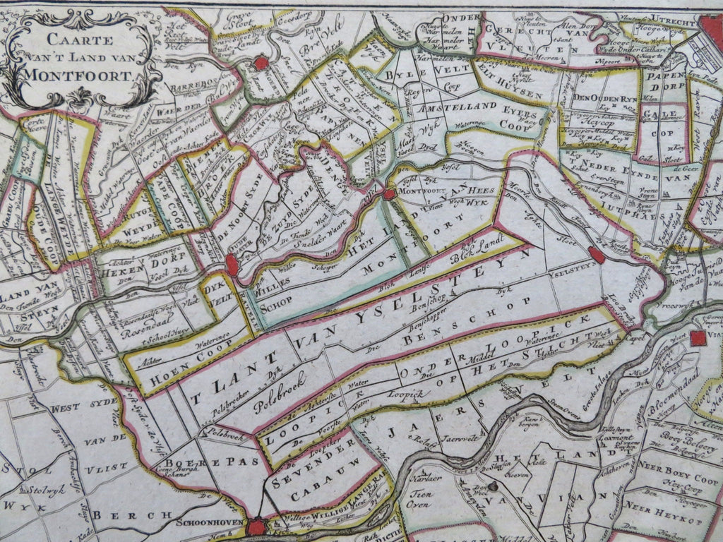

Caarte van't Land van Montfoort.
(Old Maps, 18th Century Maps, Europe, Low Countries, Netherlands, Holland, Utrecht, Montfoort).
Issued Amsterdam, Netherlands, c. 1760-85, likely by Gravius - de Lat.
Charming and undoubtedly scarce little late 18th century Dutch antique map.
Engraved with original outline hand color.
Title within small decorative scroll & vegetation cartouche top left; excellent visual appeal unique to this era and location of cartographic production.
Fresh clean example. Nice age patina, unfolded sheet, printed slightly askew.
Sheet measures c. 9 3/4" x 8"
Engraved area measures c. 8" x 7".
Koeman, Atlantees Neerlandici, v. 2, p. 122-3.
Tooley's Dictionary of Mapmakers, vol. II, pg. 205.
[B13693].