Spain & Portugal Galicia Grenada Catalonia Algarve 1820 Carey Gros & Yaeger map
Brian DiMambro- Antiquarian Books, Maps & Prints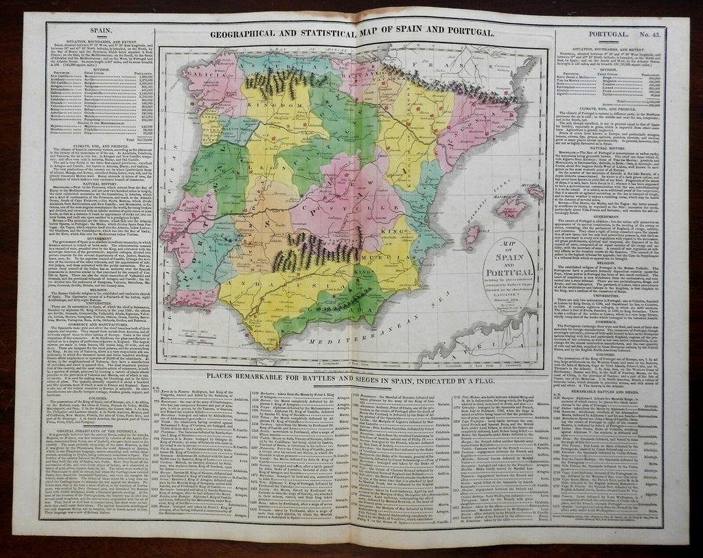
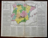
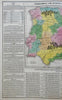
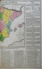
Map of Spain and Portugal...
(Europe, Iberia, Hispania, Spain, Portugal, Galicia, Asturias, Navarre, Catalonia, Aragon, Valencia, Murcia, Castille, Leon, Andalusia, Grenada, Algarve).
Issued c. 1820-5, Philadelphia by M. Carey & Son. Map by C. Gros & E. Paguenaud. Engraved by J. Yaeger.
Early 19th century engraved map with original hand color. Map surrounded by extensive and historical encyclopedic text information. Please see photos.
Nice looking example, pleasing age patina, any minor age flaws easy to overlook or forgive.
Sheet Measures c. 17 3/8" H x 22 1/4" W.
Engraved Area Measures c. 10 1/2" H x 13" W.
Cartographic Reference(s):
Tooley's Dictionary of Mapmakers, vol. 1.
[R24295].