Thrace Ancient World Byzantium Dardanelles 1740-60 Seale engraved map
Brian DiMambro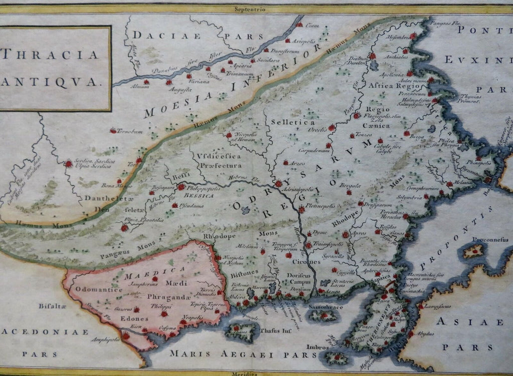
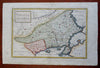
Thracia Antiqua.
(Old Maps, 18th Century Maps, Europe, Trace, Balkans, Roman Empire, Byzantium, Danube River).
Issued c. 1740-60, London by R.W. Seale.
Mid 18th century engraved map with lovely hand color.
Remains a nice looking example with a pleasing age patina. Any age flaws mostly minor and easy to overlook or forgive.
Original center fold as issued.
Sheet Measures c. 10" H x 15" W.
Engraved Area Measures c. 8" H x 12" W.
Cartographic Reference(s):
Tooley's Dictionary of Mapmakers, vol. 4.
[R30378].