Tibet Lhasa Shoke Eskerdu Tchiron Poridson Himalayas 1790 Neele engraved map
Brian DiMambro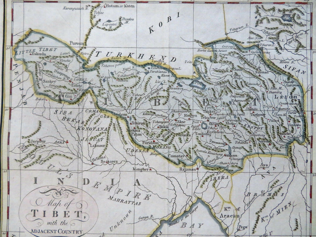

A Map of Tibet with the Adjacent Country.
(Old Maps, 18th Century Maps, Asia, Tibet, Himalayas, Lhasa, Shoke, Eskerdu, Tchiron, Poridson).
Issued 1790, London by Trusler. Engraved by Neele.
Uncommon / scarce late 18th century engraved map with attractive hand color. A relatively early English map focusing on this country.
Remains a nice looking example with a pleasing age patina. Any age flaws mostly minor and easy to overlook or forgive.
Original fold lines as issued.
Sheet Measures c. 8 1/4" H x 9 3/4" W.
Engraved Area Measures c. 7 1/2" H x 8 3/4" W.
Cartographic Reference(s):
Tooley's Dictionary of Mapmakers, vol. 4.
[R31015].