Upper & Lower Rhine Provinces Germany Holy Roman Empire 1714 detailed map
Brian DiMambro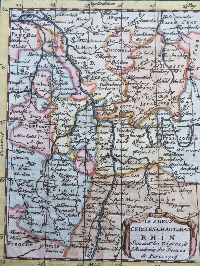
Les Deux Cercles du Haut et Bas Rhin.
(Old Maps, 18th Century Maps, Europe, Holy Roman Empire, Germany, Upper Rhine, Lower Rhine, Cleves, Dusseldorf, Manheim, Strasbourg, Bonn, Cologne, Mainz).
Issued 1714, Paris.
Early 18th century engraved map with attractive hand color.
Remains a nice looking example with a pleasing age patina. Any age flaws mostly minor and easy to overlook or forgive.
Sheet Measures c. 8 1/4" H x 6 1/4" W.
Engraved Area Measures c. 7" H x 5 1/4" W.
[B13196].