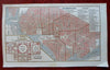
Washington D.C. City Plan Government Buildings Capitol Floor Plan 1853 nice map
Brian DiMambro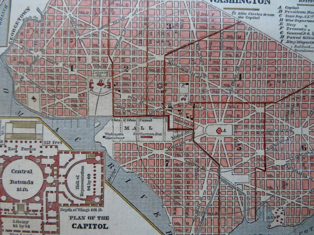
Washington.
(Old Maps, 19th Century Maps, Americana, United States, Washington D.C., City Plan, Capitol Building, White House, Mall, Government Buildings).
Issued 1853, New York by Fanning.
Uncommon and charming little mid 19th century wax engraved (cerographic) city map with lovely hand color.
Numbered key at top right locates 31 specific buildings, including six specific hotels. Issued within a scarce Gazetteer, text on reverse as always.
Remains an exceptionally nice looking example with a pleasing age patina. Any age flaws mostly minor and easy to overlook or forgive.
Sheet Measures c. 9" H x 5 1/2" W.
Engraved Area Measures c. 8 1/4" H x 4 3/4" W.
[R31681].