World in hemispheres California as Island undefined Australia c.1760 de Leth map
Brian DiMambro- Antiquarian Books, Maps & Prints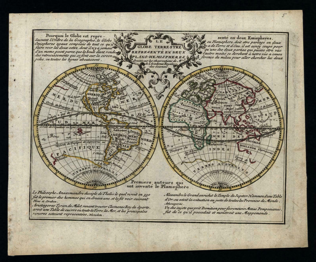
Le Globe Terrestre Represente en deux Plans-Hemispheres.
(World Map, Continents, Hemispheres, Atlantic Ocean, Pacific Ocean, Indian Ocean).
Issued c. 1760-70, Amsterdam by de Leth & Baalde, S.J. for the scarce Nieuwe Geographique en Historique Atlas pour l'Etude facile de la Geographie...
Lovely antique engraved map with original outline hand color. French language despite Dutch imprint.
Noteworthy for the depiction of prominent California as an island. Australia is still undefined in outline as is the island of Van Diemen as well as New Zealand. A huge southern continent occupies the southern hemisphere, a cartographic continuation of a much earlier misconception. Title within decorative floral and scroll cartouche, engraved description text in four corners.
Minor light surface age wear and toning as typical, some faint minor foxing in the blank margins, overall the image is clean, well preserved and very attractive. Map displays a unique age patina. Original tri-fold as issued.
Sheet measures c. 8" x 10".
Engraved area measures c. 6 1/2" x 8 1/2".
Koeman, Atlantes Neerlandici , II, Le H 1 -- a re-issue of the CHiquet atlas map of 1719 with changes made to the plate.
Tooley's Dictionary of Mapmakers, v. 2, p. 124.
[R21080].