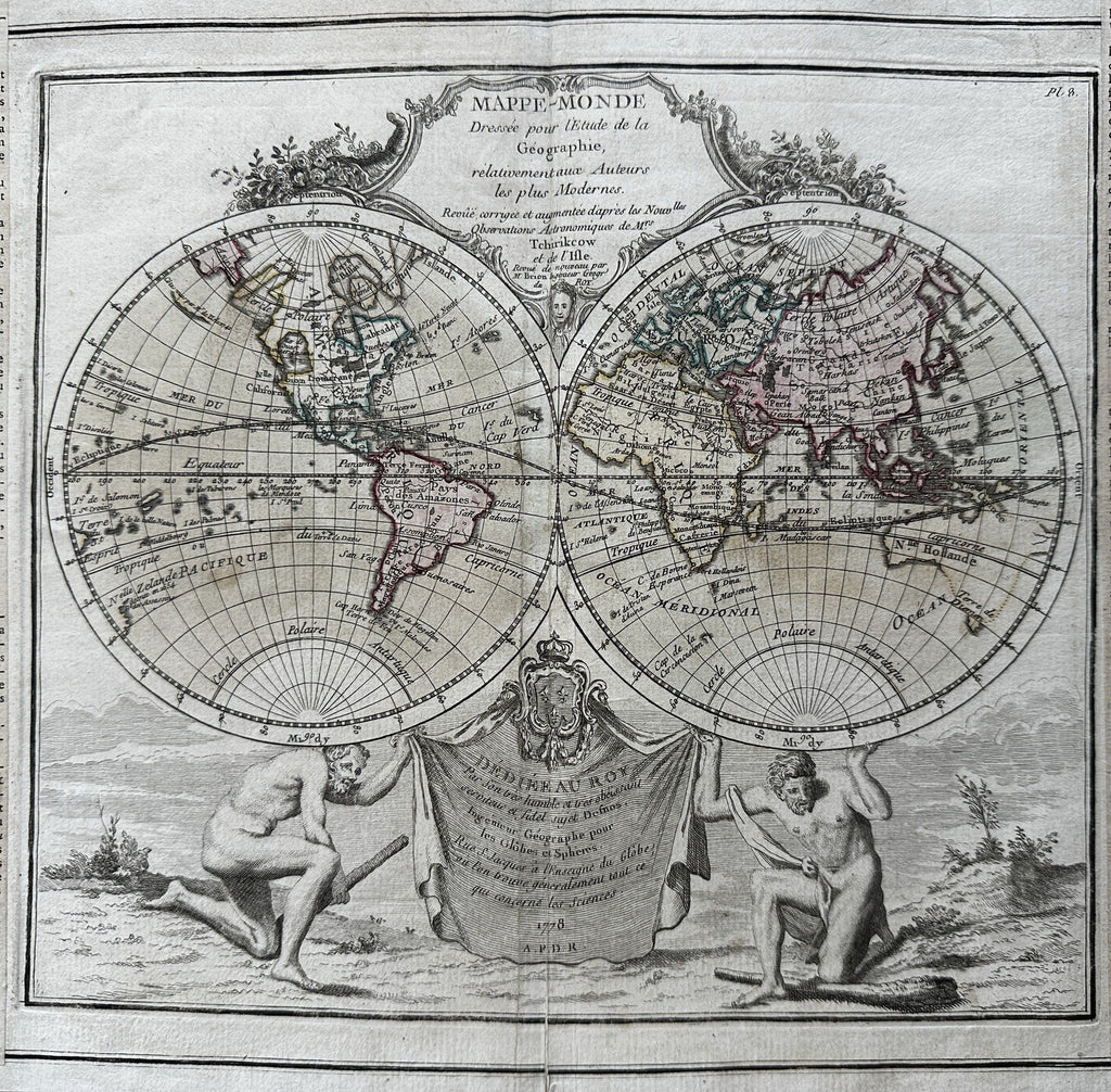
World spheres decorative cartouche Sea of West in North America 1778 Desnos map
Brian DiMambro- Antiquarian Books, Maps & Prints


Splendid decorative map with two mythological gods including Atlas holding the world spheres aloft.
Note the spectacular myth of a huge Mer de l"Ouest seen in the northwest region of North America. Note further the remarkable peninsula island shape assigned to Alaska which is near an unknown land or island off the tip of Asia. Another dramatic feature is the entirely unknown and wildly incorrect speculative shape assigned to all of eastern Australia, Pre-Cook fantasy shown with dotted lines which connect it to Van Diemens island as well as New Guinea and the rest of the ocean. Bottom left sphere names a Land of St. Spirit
A nice looking example, inoffensive signs of time and almost 250 years of careful handling, small old paper repair to bottom centerfold blank margin, short 1/2" split at top of centerfold, slight creasing along center fold line, overall map displays a very pleasing age patina. Nice map with strong visual impact.
Original fold line as issue, small old paper repair at bottom centerfold as seen.
French letter press explanatory text lines both sides which includes much detailed historical information.
Sheet size c.13 1/4" H x 19 5/8" W.
Engraved area w/ text c.11" H x 18 7/8" W.
Map area only c. 9 1/4" H x 10 3/8" W.
Pictures show this wonderful and desirable mid-18th century decorative world map well. Please review them carefully at your leisure so you may clearly see what you are buying.
R36491
