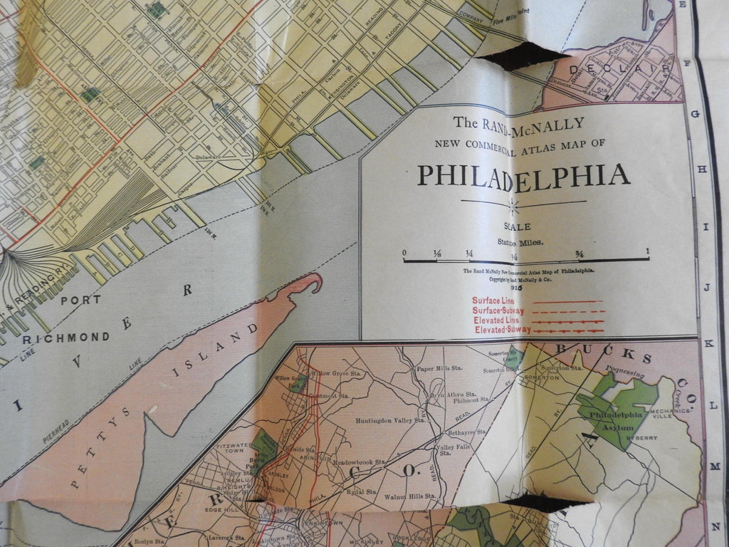
Philadelphia Pennsylvania 1916 detailed city plan w/ elevated subway electric
Brian DiMambro- Antiquarian Books, Maps & Prints


(North America, United States, Pennsylvania, Philadelphia, City Plan).
Philadelphia - Rand McNally Vest Pocket Map Showing Streets, Transportation Lines, Parks, Public Buildings, Etc.
Published 1916, Chicago by Rand McNally & Company.
Uncommon oversize early 20th century color lithographed folding pocket map. Inset Philadelphia Environs map lower right.
Transitional issue, overprinted in red to show the routes and stops of five different transportation lines, including surface lines, surface subway lines, elevated lines, elevated subway lines and finally, electric lines. Issued at the early dawn of the rise of wide-spread urban automobile usage, towards the final years of these early methods. Numerous key buildings named.
Lettered pictorial cardstock covers, now corner chipped and top cover loose.
Map and paper is over 100 years old and shows some signs of handling and time, but remains quite clean. Map is not new or in "new" condition but rather has numerous long splits along the old fold lines. Map needs to be backed prior to hanging for display.
Map paper has age toned and is now well split along several fold lines and in numerous different locations.
Please review photos for more detail and our best attempt to convey how this uncommon antique pocket map survives.
Book Measures c. 6 1/4" H x 4" W.
[B2222].
