Tibet Gobi Desert Mughal Empire India Himalayas Kashgar c. 1749 engraved map
Brian DiMambro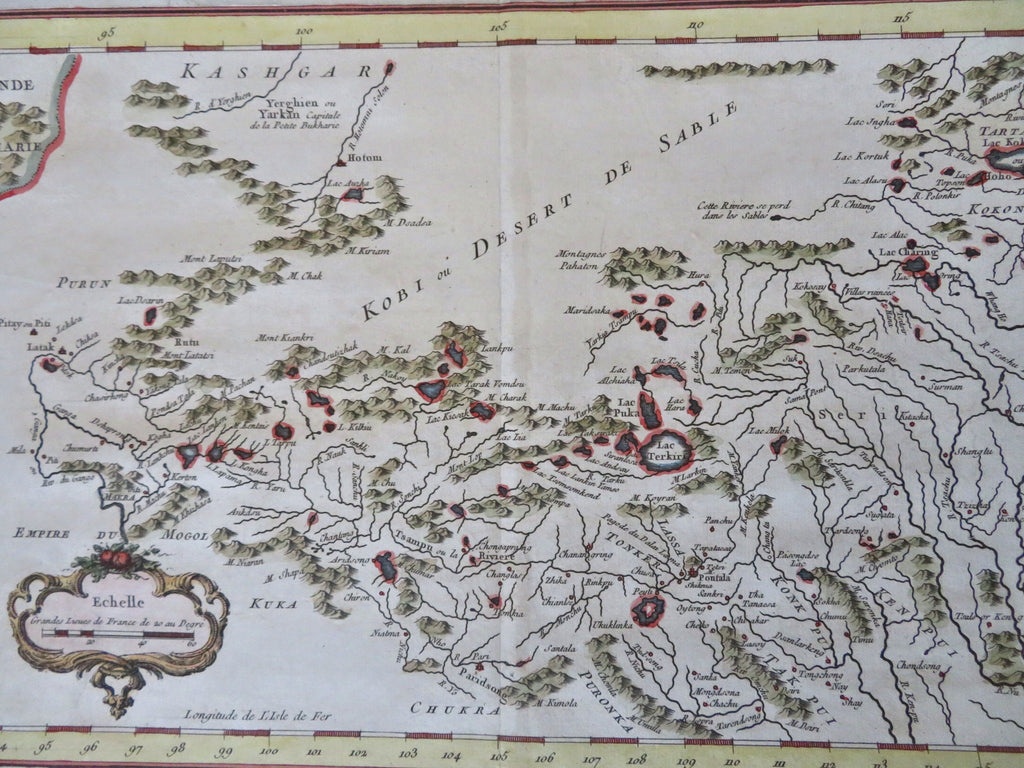
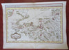
Carte De L'Empire de Hya et Partie de Tangut.
(Old Maps, 18th Century Maps, Asia, Central Asia, Gobi Desert, China, Tibet, Mongolia, Karakorum).
Issued c. 1749, Paris by Bellin.
An early map depicting Tibet. Llassa is located to the right of the centerfold, slightly below the middle.
Mid 18th century engraved map with attractive hand color.
Remains a nice looking example with a pleasing age patina. Any age flaws mostly minor and easy to overlook or forgive.
Original center fold as issued.
Sheet Measures c. 10 1/4" H x 14" W.
Engraved Area Measures c. 8 3/4" H x 12 1/4" W.
[R35051].