Annis Squam Harbor Ipswich Bay Mass. 1833 Blunt coastal survey nautical map
Brian DiMambro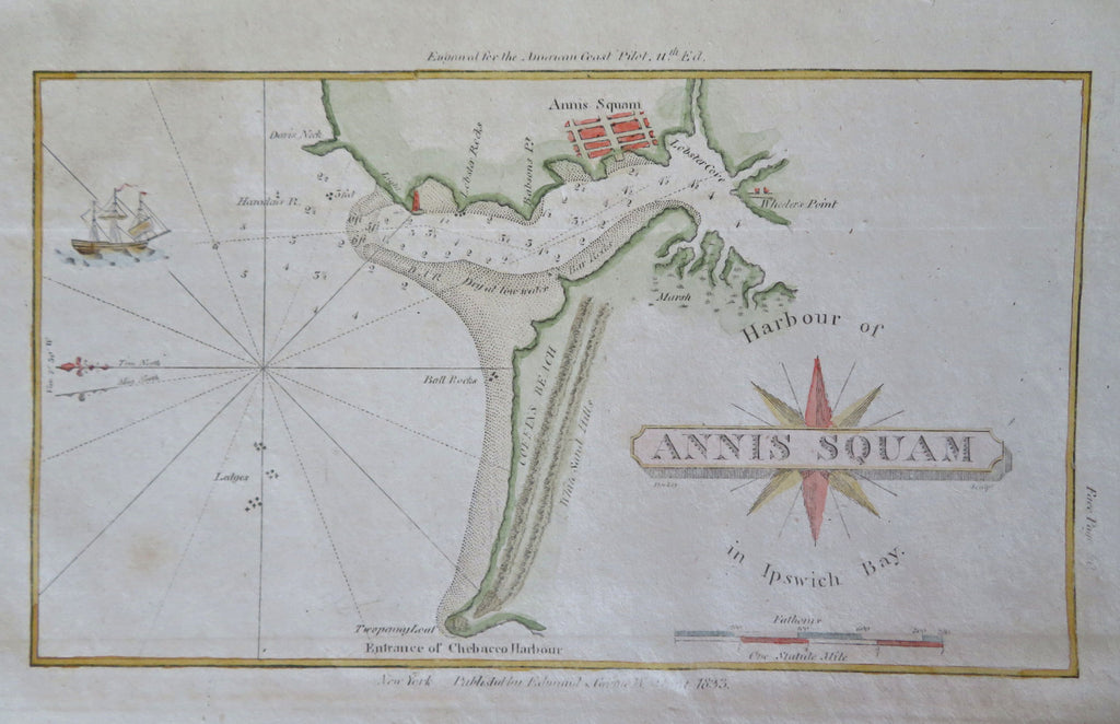


Harbour of Annis Squam in Ipswich Bay.
(Old Maps, 19th Century Maps, Nautical Surveys, Coastal Charts, North America, United States, New England, Massachusetts, Ipswich Bay, Annis Squam Harbor).
Issued 1833, New York by George W. Blunt.
Mid 19th century coastal survey with attractive hand color.
Tall mast ship at left has a track leading into the harbor. The rhumb lines and sounding depths impart a strong nautical feel.
Remains a nice looking example with a pleasing age patina. Any age flaws mostly minor and easy to overlook or forgive.
Sheet Measures c. 5 3/4" H x 9 1/4" W.
Engraved Area Measures c. 4" H x 7" W.
Cartographic Reference(s):
Tooley's Dictionary of Mapmakers, vol. 1.
[B13245].