Lower Saxony Germany Holy Roman Empire Magdeburg Hanover 1757 Kitchin map
Brian DiMambro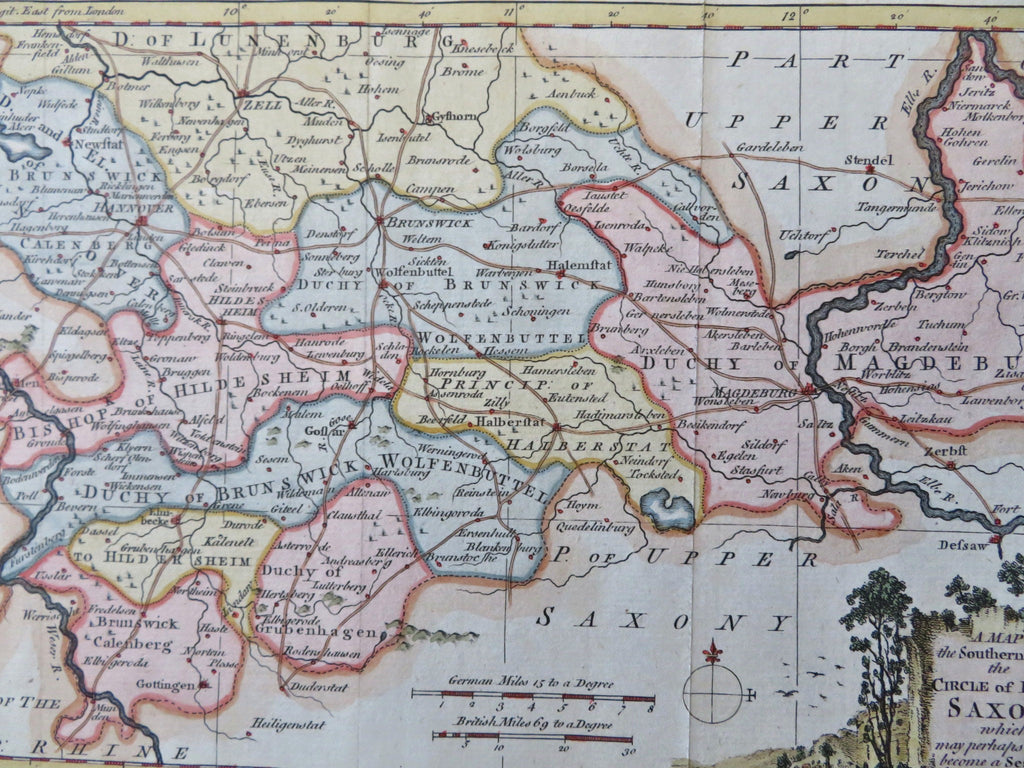
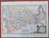
A Map of the Southern Part of the Circle of Lower Saxony, Which May Perhaps Soon Become a Seat of War.
(Old Maps, 18th Century Maps, Europe, Holy Roman Empire, Germany, Lower Saxony, Hildesheim, Brunswick, Magdeburg, Hanover).
Issued 1757, London for London Magazine. Engraved by T. Kitchin.
Mid 18th century engraved periodical map with attractive hand color. Decorative cartouche greatly enhances visual appeal.
Remains a nice looking example with a pleasing age patina. Any age flaws mostly minor and easy to overlook or forgive.
Original fold lines as issued.
Sheet Measures c. 8" H x 10 1/2" W.
Engraved Area Measures c. 6 1/2" H x 9 3/4" W.
Cartographic Reference(s):
Tooley's Dictionary of Mapmakers, vol. 2.
[B13197].