Abyssinia Nubia Egypt Northeast Africa Nile source 1701 Moll engraved map
Brian DiMambro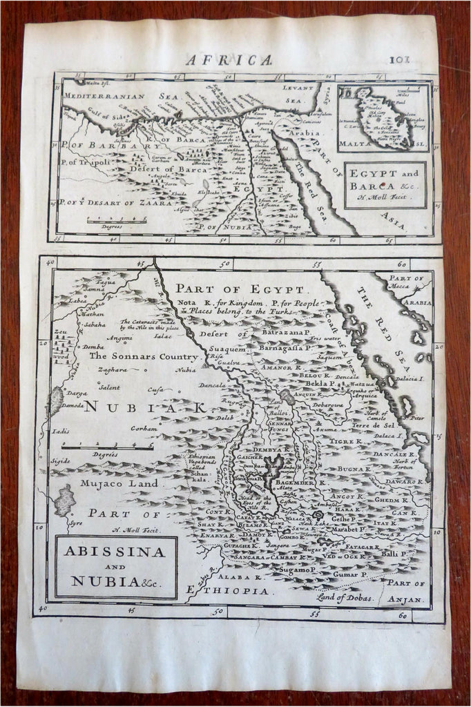
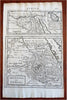
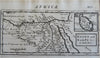
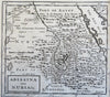
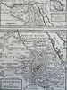
Egypt and Barca - Abissina and Nubia &c.
(Old Maps, 18th Century Maps, Africa, North Africa, East Africa, Egypt, Abyssinia, Nile River, Red Sea, Nubia, Libya, Cairo, Alexandria, Malta).
Issued 1701, London by Churchill. Engraved by Moll.
The Nile river starts in a giant lake within mountain ranges (Mts. of the Moon). A key notes places that belong to the Turks. Mecca in Arabia is named at top right corner of this map. A small inset of Malta is seen above the Egypt map title box.
Early 18th Century engraved map. On reverse is a large single map of southern Africa titled "Congo, Angola, Cafres, Mono-Emugi, Monomotapa, Zanguebar & Madagascar.
Nice looking example, pleasing age patina, any minor age flaws easy to overlook or forgive.
Sheet measures c. 12 3/4" H x 8" W.
Engraved area measures c. 10 1/4" H x 7 1/2" W.
Cartographic Reference(s):.
Tooley's Dictionary of Mapmakers, vol. 3.
[R31098].